 Intelligent

Revolutionizing Aerial Surveying with the DJI Zenmuse P1
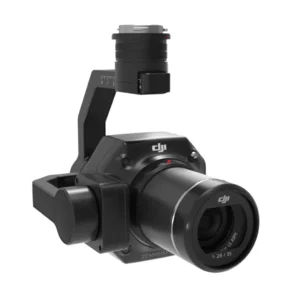
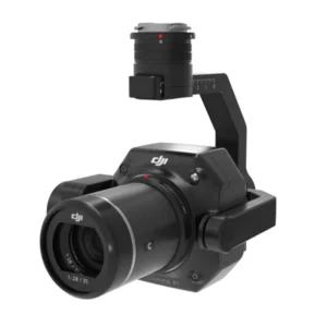
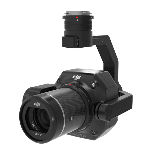
DJI Zenmuse P1 Full-Frame 45MP Photogrammetry & Surveying Camera
The DJI Zenmuse P1 redefines the benchmarks for precision and efficiency in aerial surveying, combining innovative features with unmatched data accuracy. Designed for professionals seeking high performance in photogrammetry and mapping applications, this full-frame camera system with a 3-axis gimbal is the ultimate tool to elevate your aerial surveying missions.
Precision and Efficiency Like Never Before
The Zenmuse P1 delivers professional-grade efficiency and accuracy, making it an indispensable tool for industries that demand detailed and reliable data.
- Large-Area Coverage: Survey up to 3 km² in a single flight, reducing operational time and increasing productivity.
- Unrivaled Accuracy: Achieve horizontal accuracy of 3 cm and vertical accuracy of 5 cm, even without Ground Control Points (GCPs).
- Rapid Data Capture: Capture images every 0.7 seconds, ensuring fast yet precise data collection for large-scale projects.
The Zenmuse P1 doesn’t just meet industry standards—it surpasses them.
Features Designed for Unmatched Performance
The Zenmuse P1 comes equipped with cutting-edge technology tailored to meet the demands of modern aerial surveying:
- 45 MP Full-Frame Sensor: Delivering high-resolution imagery with low noise for superior detail in every shot.
- Global Mechanical Shutter: Ensures sharp images even at high flight speeds with a shutter speed of up to 1/2000 seconds.
- TimeSync 2.0: Achieves microsecond-level synchronization between all system components, guaranteeing data accuracy.
- Smart Oblique Capture: Revolutionizes oblique photography by capturing only essential images at the edges, improving post-processing efficiency by up to 50%.
Adaptable for Various Missions
Flexibility is at the core of the Zenmuse P1’s design. Its compatibility with interchangeable 24mm, 35mm, and 50mm fixed-focus lenses ensures it meets the unique demands of different industries. Whether creating 2D orthomosaics or 3D models, the P1 delivers consistent, accurate results.
Smart Data Management
- Centralized Data Storage: Automatically organizes mission files by name and time.
- Comprehensive Metadata: Includes GNSS data, timestamps, and camera parameters, enabling immediate verification of data accuracy.
- Post-Processing Optimization: Streamlined workflows with advanced tools ensure fast and efficient results.
Industry Applications for the Zenmuse P1
The Zenmuse P1 is a versatile tool, suited for a broad range of applications:
Topographic Mapping: Create detailed 2D maps with 1:500 scale accuracy, all without relying on GCPs.
Cadastral Surveying: Generate highly accurate 3D models for land ownership and boundary analysis, essential for legal and governmental use.
AEC and Surveying: Optimize every phase of construction, from design to monitoring, using precise 2D and 3D data.
Natural Resource Management: Monitor forests, water bodies, and land use to support environmental conservation efforts.
Geological Investigation: Safely survey hazardous sites and create millimeter-accurate models for geological analysis.
Disaster Site Modeling: Provide real-time 3D overviews of disaster areas to aid decision-making during emergency responses.
Advanced Software Integration
With DJI Terra, the Zenmuse P1 becomes a complete solution for data collection, processing, and analysis.
- One-Click Processing: Generate 3D models, point clouds, and Digital Elevation Models (DEMs) with ease.
- Real-Time Results: Preview point cloud models during missions to validate data before leaving the site.
- Detailed Analysis: Leverage tools for ground point classification and elevation accuracy inspection.
Why Choose the DJI Zenmuse P1 from DSLRPros?
At DSLRPros, we specialize in providing top-of-the-line solutions tailored to your aerial surveying needs:
- Expert Guidance: Our team ensures you get the right configuration and training for your projects.
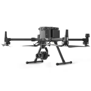
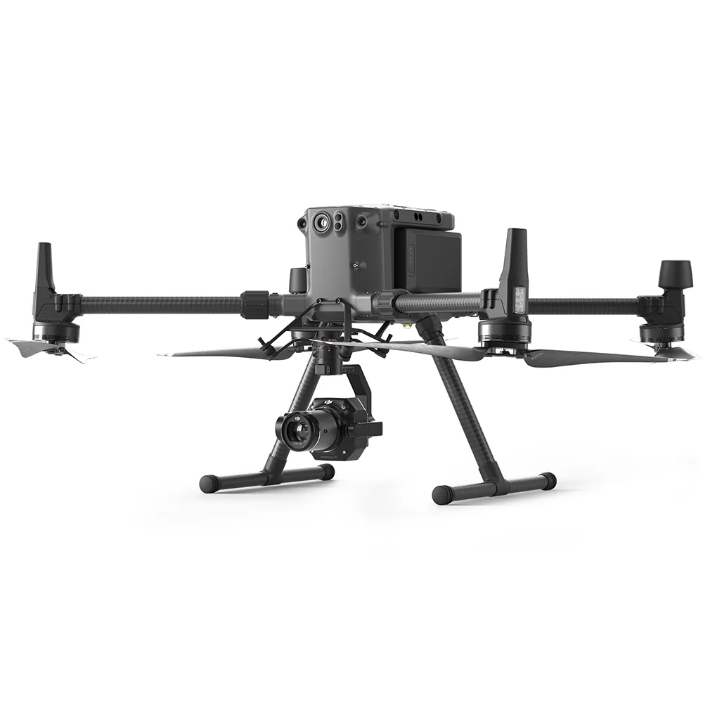
- Complete Solutions: From compatible drones like the DJI Matrice 300 RTK to essential accessories, we’ve got you covered.
- Unmatched Support: We offer ongoing assistance to help you make the most of your Zenmuse P1 system.
Transform Your Surveying Operations Today
The DJI Zenmuse P1 isn’t just a camera—it’s a game-changer in aerial surveying. Whether you’re tackling large-scale mapping projects, conducting environmental monitoring, or optimizing disaster response, the P1 offers the tools you need to exceed expectations.
Contact us at DSLRPros to explore how the Zenmuse P1 can redefine your operations.
🔗Contactez-nous
✅ Website: greenimtech.com
✅ Email: jackl@greenimtech.com
🔗More industry information
Trimble Global leader in measurement and positioning technology: https://www.trimble.com
Septentrio GNSS anti-interference antenna expert, technical supplement for positioning in complex environments: https://www.septentrio.com
Topcon positions itself as the benchmark for construction automation, a cross-industry reference for our construction guidance system: https://www.topconpositioning.com
A pioneer in the field of Velodyne Lidar, enhancing the 3D modeling and mapping capabilities of Haida UAVs: https://www.velodynelidar.com 3D LiDAR
DJI, the global leader in drones, collaborates with our unmanned ship and RTK equipment ecosystem: https://www.dji.com
Quanergy, an innovator in solid-state LiDAR, complements our UWB positioning in autonomous driving: https://www.quanergy.com
State Grid, our core customer of power + positioning solutions, shows a transmission line monitoring case: http://www.sgcc.com.cn
EDF Group Global Energy Benchmark, the international benchmark for our water monitoring: https://www.edf.com
FiRa Coalition UWB technical standards organization provides technical certification for our UWB integration positioning: https://www.firacoalition.org
IGS (International GNSS Service) Global satellite navigation authority, our Beidou Ground Augmentation System authoritative link: https://www.igs.org


