 Intelligent
 From the Eye in the Sky to Ground-Level Assistance:
How Drones Are Reshaping Every Industry
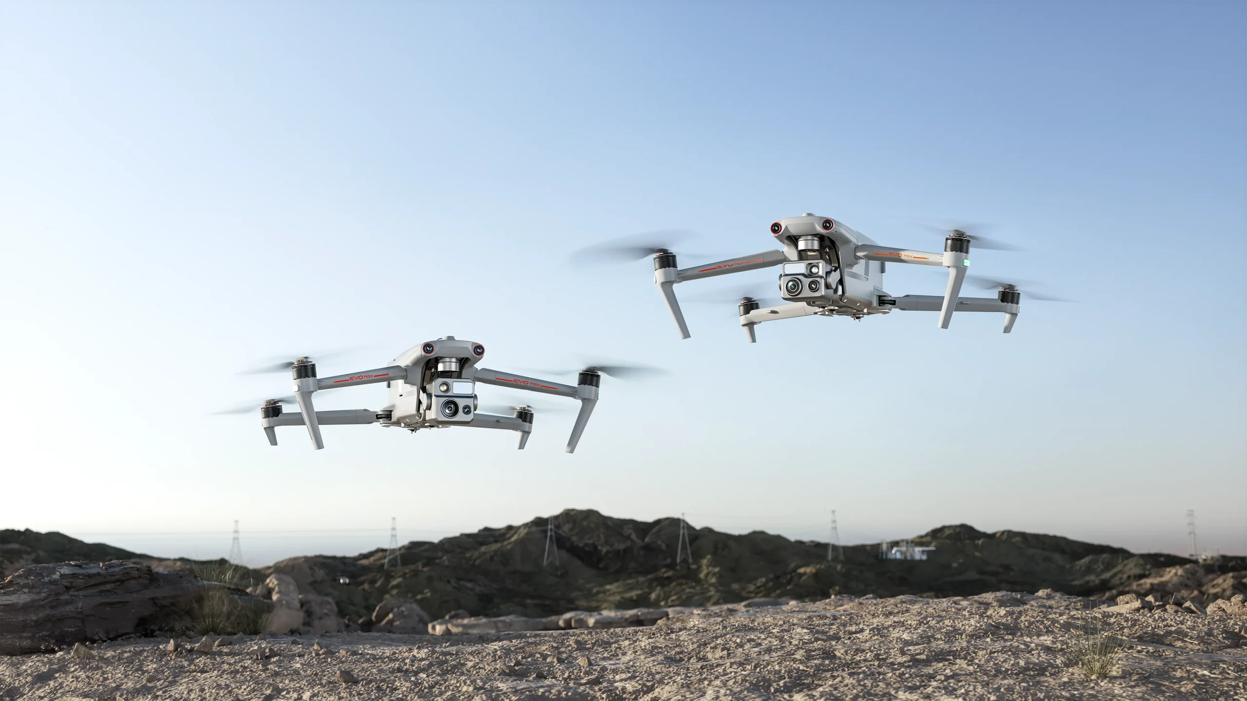
Drones are no longer limited to photography or hobbyist use. They are now transforming the way industries operate across the board. With unmatched speed and efficiency, drones are becoming essential tools in inspection, logistics, environmental monitoring, public safety, and more. Whether you’re an industry professional or a tech enthusiast, understanding the broad applications of drones is key to staying ahead.
Here is a comprehensive look at the core sectors where drones are revolutionizing workflows:
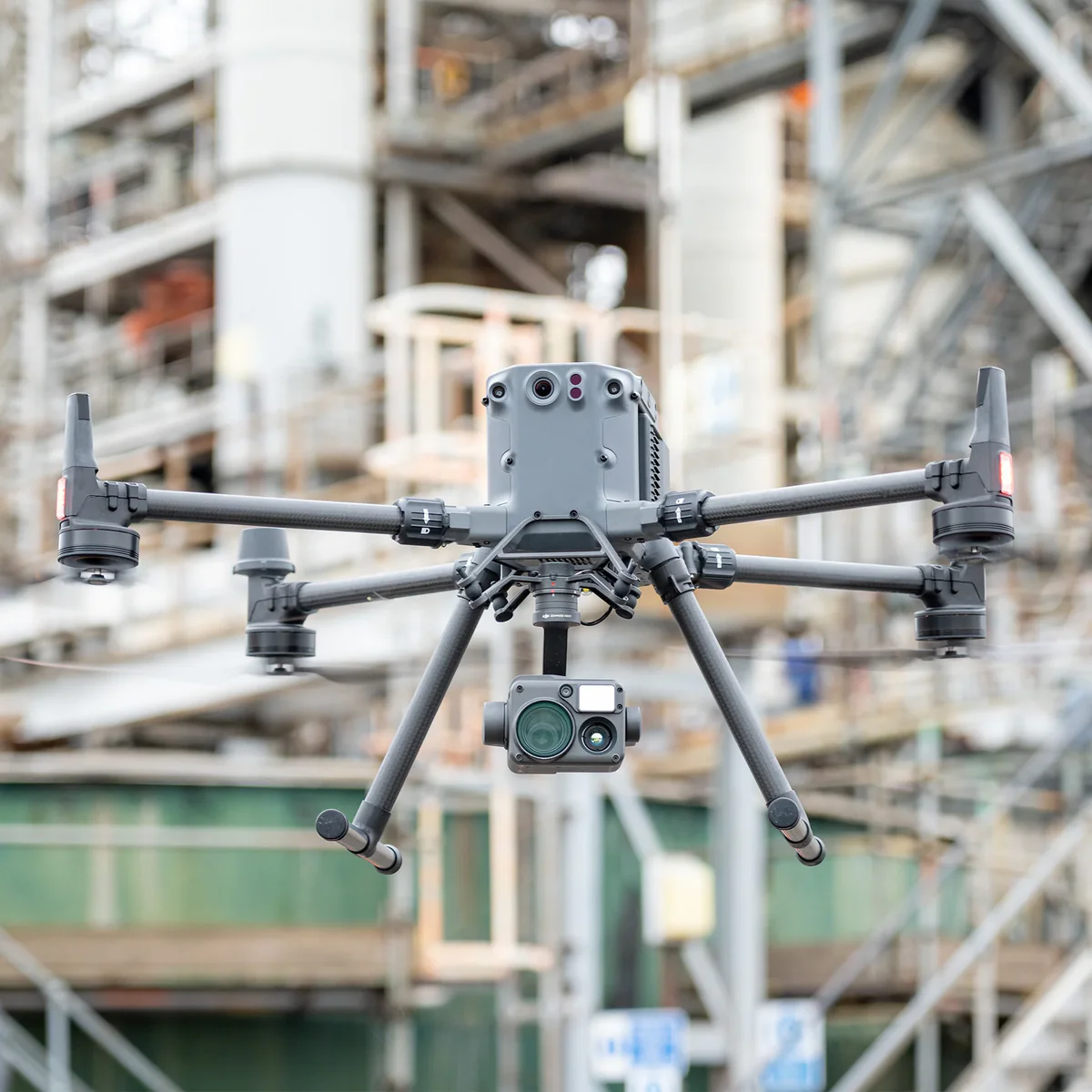
1. Inspection: Safe, Efficient, and Risk-Free
1.1 Precision Asset Inspection
Functions: Quickly identify cracks, leaks, corrosion, and other defects at close range.
Key Technologies:
- High-precision positioning & autonomous navigation (via UWB, visual markers, or LiDAR SLAM in GPS-denied zones)
- Enhanced safety with LiDAR-based obstacle avoidance
- Intelligent data collection with 3D modeling, HD imaging, and edge video AI for moving targets
- Communication: Primarily via private 5G networks with onboard or cloud-based AI
1.2 Roof Inspections
Advantages: Replace risky manual work, drastically cut inspection time, and improve worker safety.
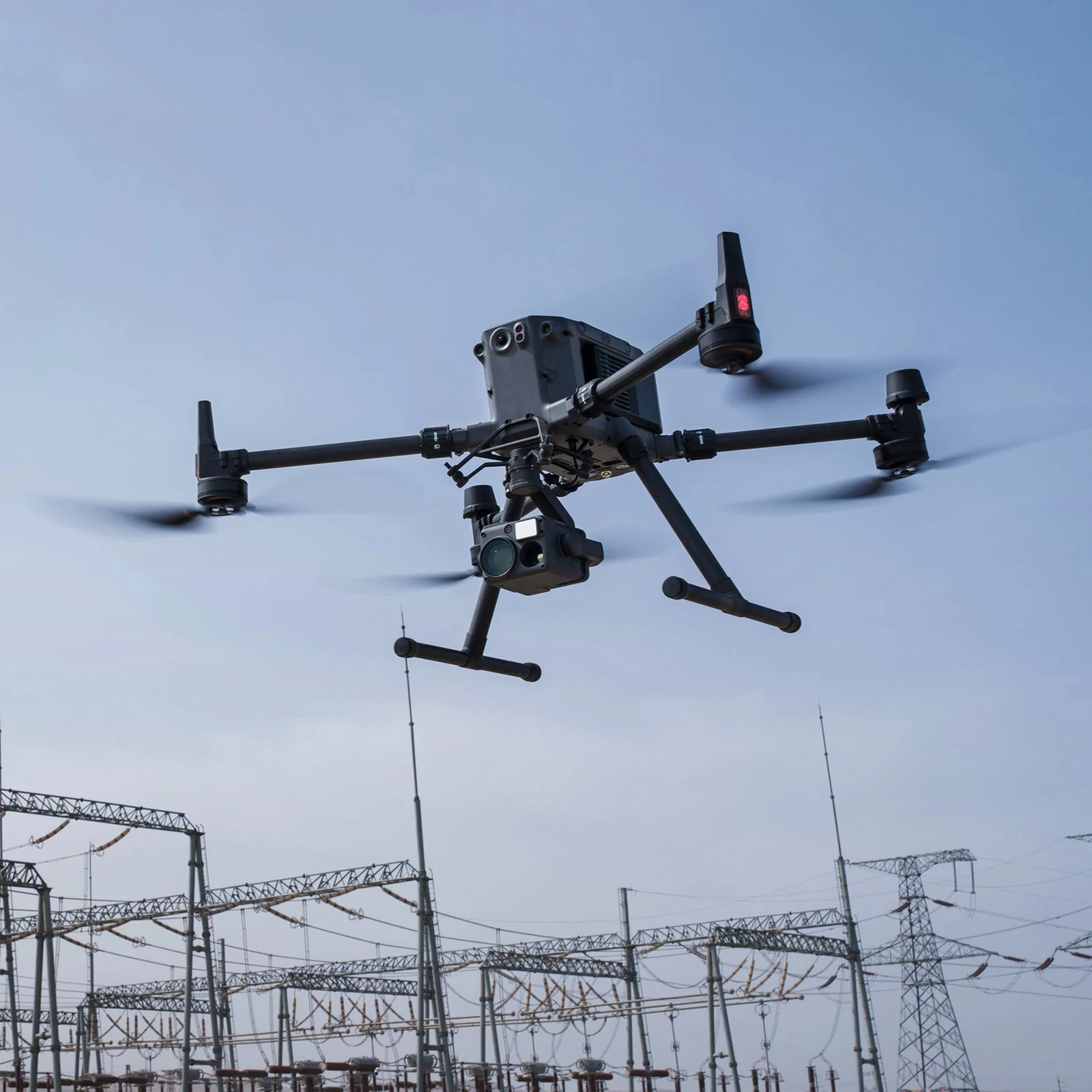
1.3 Power Plant and Grid Inspection
Benefits: Prevent outages, enable fault diagnosis from the ground, and speed up repairs.
1.4 Telecom Tower Inspection
Outcome: High-resolution imaging for accurate evaluation and faster, safer operations.
1.5 Oil & Gas Facilities
Result: Consistent, rapid data collection; reduced downtime and operational risks.
2. Surveillance & Management: Wide-Area Visibility and Smarter Decisions
2.1 Waste Management
Applications: Optimize garbage collection, monitor landfills, and even perform automated trash pickup.
2.2 Road Safety
Scenarios: Risk assessments, accident investigations, and real-time road monitoring.
Challenges & Solutions:
- All-weather operations (night vision, fog, rain, etc.)
- Long-range 5G communication and SLAM navigation in tunnels
- AI-driven incident detection and tracking
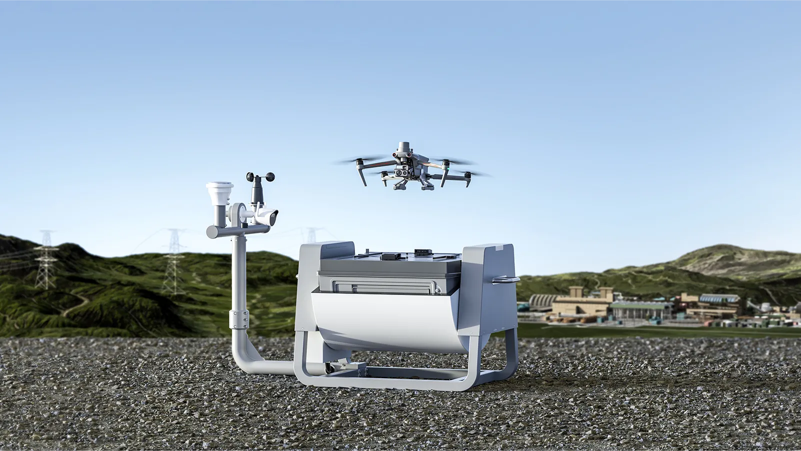
- Leapfrog flight via drone docking stations
2.3 Traffic Monitoring
Uses: Extract live traffic data for improved planning and congestion management.
2.4 Infrastructure Management
Focus: Bridge inspections and road damage detection.
2.5 Precision Agriculture
Advantages: Rapid crop scanning, health monitoring, stress detection, and precision treatment.
2.6 Environmental Protection
Why it matters: Enables fast, safe, and cost-effective environmental monitoring, especially in remote or dangerous areas.
2.7 Disaster Relief
Key Capabilities: Rapid deployment, infrared search, medical delivery, and real-time mapping.
2.8 Forestry Management
Applications: Tree health monitoring, canopy mapping, biomass analysis, and planting support.
2.9 Port and Marine Surveillance
Benefits: Monitor hard-to-reach areas, vessel assessments, port traffic control, and marine environmental safety.
2.10 Waterway & Coastal Operations
Uses: Ship monitoring, water quality, weather tracking, and marine life surveys.
3. Cargo & Logistics: Heavy-Lift Aerial Corridors
3.1 Industrial Lifting
Scenarios: Construction site material delivery, power grid equipment installation, offshore platform supply.
- Benefits: Replace high-risk human lifting; pinpoint aerial delivery with <10cm accuracy; support 100kg payloads (e.g., DJI Matrice 30T)
3.2 Emergency Medical Delivery
Examples: Cross-city vaccine, blood, or organ transport
- Value: Cuts delivery time by up to 70% in mountainous or disaster-hit areas; temp-controlled cabins for biosecurity; 24/7 rapid response
3.3 Commercial Logistics
Innovation: Drone delivery hubs (e.g., SF Express “Ark”)
- Efficiency: Thousands of deliveries per day; 30% lower last-mile cost
4. Emergency Response: Aerial Command at Your Fingertips
4.1 Disaster Assessment
Tools: LiDAR + thermal imaging for 3D mapping through smoke; multispectral sensors for chemical tracking
- Speed: Map 10 sq km in 15 minutes
4.2 Smart Dispatch
Features: Locate victims via AI-based face and heat detection; plan optimal rescue paths; coordinate drones for lighting, messaging, and supply drops
4.3 Secondary Disaster Prevention
Applications: Dam seepage detection, wildfire monitoring, hazardous material containment with robotic arms
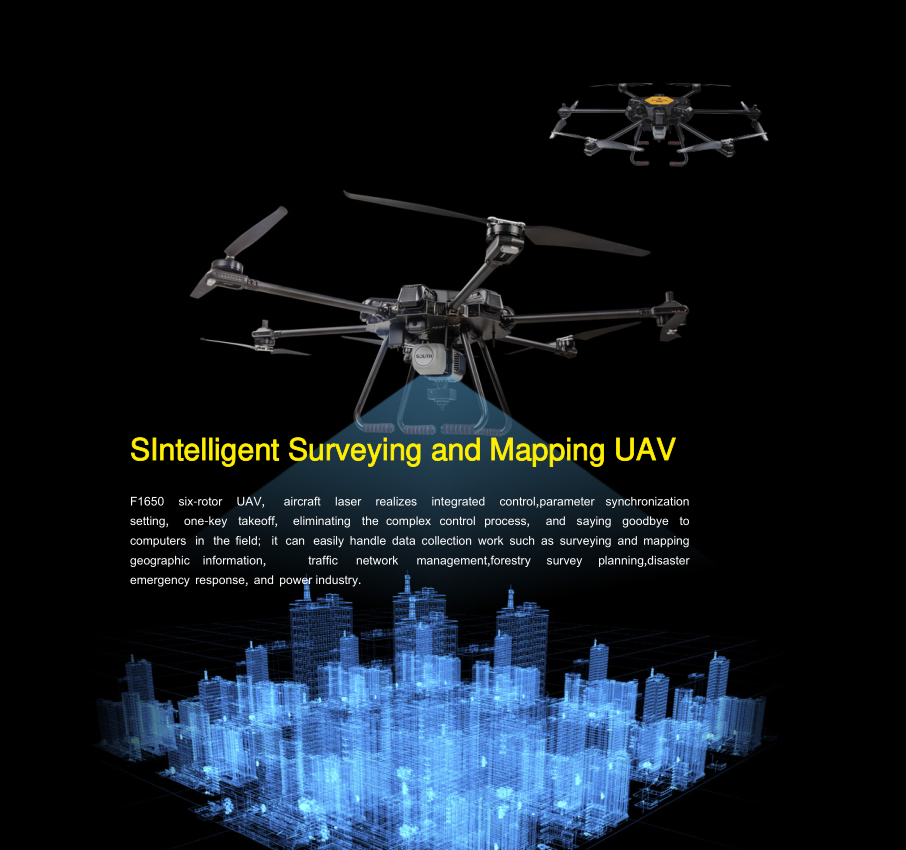
5. Surveying & Mapping: Centimeter-Level Accuracy
5.1 Aerial LiDAR Mapping
Advantages: Generate highly detailed 3D models from 100–200 meters altitude
5.2 3D Modeling & Orthophoto Imaging
Functions: Build precise 3D maps and orthophotos even in complex terrain
5.3 General Surveying
Applications: Urban planning, land registry, metro mapping, and more
5.4 Mining Applications
Uses: Terrain modeling, volume estimates, security, and site inspections
5.5 Landfill Monitoring
Benefits: Early detection of leaks or hazards to prevent environmental damage
6. Construction & Real Estate: A New View of Development
6.1 Land Development
Support: Accelerate site surveying, terrain mapping, and planning
6.2 Civil Engineering
Advantage: Low-cost, high-resolution data capture for digital models
6.3 Real Estate Marketing
Highlight: Showcase properties and surroundings with immersive aerial photos and videos
7. Photography & Videography: A Creator’s Eye in the Sky
7.1 Film Production
Impact: Capture breathtaking angles and boost production value
7.2 Weddings & Events
Effect: Highlight scale and beauty of gatherings through cinematic aerial views
7.3 Advertising
Use: Generate eye-catching marketing visuals and videos
7.4 Promotional Photography
Value: Beautiful aerial shots draw customer attention and boost sales

8. Power & Telecom: Precision, Safety, and Efficiency
8.1 Power Industry
Core Benefits:
- Enhanced safety: No need for climbing towers; avoids fall hazards
- Cost savings: Shorter maintenance cycles and fewer outages
- Reliable results: AI-powered defect detection in challenging environments
- Rich data: Capture visuals via zoom cameras, IR sensors, UV imaging, and LiDAR
- Environment adaptable: Operates in GPS-denied, low-light, or confined spaces
- Smart workflows: Integrated software (e.g., inSite) standardizes inspections
8.2 Telecom Infrastructure
Unmatched Advantages:
- Zero climbing: Removes weather-related and fall risks
- High efficiency: Rapid, precise data collection
- Minimal network disruption: Check multiple sites in one flight
- Economic: Reduces costs vs. cranes or helicopters