 賢い
賢い

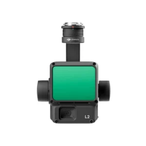
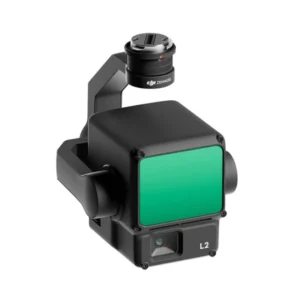
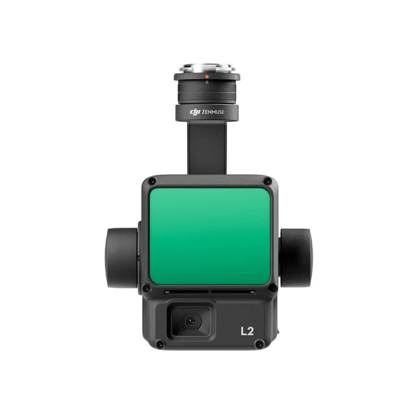
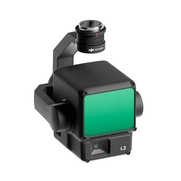
DJI Zenmuse L2 LiDAR Sensor for Matrice 350/300
Make 3D Data Collection Seamless with DJI Zenmuse L2
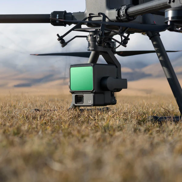
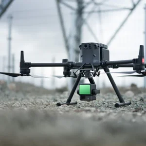
The DJI Zenmuse L2 is a state-of-the-art LiDAR system designed to elevate aerial 3D data collection to new heights. As the successor to the Zenmuse L1, the L2 is equipped with advanced features, enhanced accuracy, and a robust design that redefines efficiency for professionals in industries like surveying, forestry, and infrastructure management. When paired with the DJI Matrice 300 RTK or Matrice 350 RTK drones, this LiDAR solution becomes a powerhouse for capturing reliable, precise, and actionable 3D data.

More Power, Greater Efficiency
The Zenmuse L2 brings cutting-edge aerial LiDAR technology to industries that demand fast, large-scale, and accurate spatial information. Whether you’re managing forestry assets, inspecting infrastructure, or conducting land surveys, this LiDAR system outpaces traditional manual measurement methods by dramatically reducing fieldwork time and increasing detection efficiency.
- Integrated Power: The Zenmuse L2 combines a LiDAR module, 4/3 CMOS RGB camera, self-developed IMU system, and three-axis gimbal into a seamless package.
- Unmatched Compatibility: Designed for integration with DJI’s Matrice series drones, it ensures precision and reliability in every mission.
Ready for Action Anytime
The Zenmuse L2 is engineered for readiness and ease of use. The enhanced IMU system delivers high accuracy the moment it powers on, ensuring faster deployment in the field.
- Real-Time Accuracy: Leveraging the drone’s RTK positioning system, the Zenmuse L2 processes highly accurate data with absolute position, speed, and attitude information during post-processing.
- Adaptability in Challenging Conditions: The improved IMU system ensures operational reliability and precision, even in extreme environments.
Enhanced Detection Range for Safer Operations
The Zenmuse L2 boasts a significant leap in detection range and performance.
- Extended Detection: Detects objects up to 450 meters away at 50% reflectivity, with a typical operational altitude of 150 meters.
- Improved Spot Size: The reduced spot size allows for better object detection and more detailed digital elevation models (DEMs).
- Multiple Returns: The system supports five returns, making it capable of penetrating dense vegetation and capturing ground points beneath foliage.
These upgrades enhance operational safety and allow for higher data collection efficiency across challenging terrains.
Superior Imaging with the RGB Camera
The Zenmuse L2’s 4/3 CMOS RGB camera has been upgraded to deliver even better imaging capabilities.
- Exceptional Detail: A 20 MP sensor with a mechanical shutter and enlarged pixel size captures enriched, colorized point cloud data.
- Fast Operation: A minimum photo interval of 0.7 seconds and a shutter count of up to 200,000 reduce operational costs and downtime.
- Versatile Use: Beyond point cloud data, the RGB camera can capture high-resolution photos and videos for traditional mapping tasks.
Streamlined Software for Total Control
The Zenmuse L2 integrates seamlessly with DJI Pilot 2, offering intuitive operation and real-time feedback.
- Multiple Display Modes: Choose from RGB, point cloud, or side-by-side displays to monitor data collection progress.
- Enhanced Safety Features: The Laser Rangefinder (RNG) provides precise distance measurements, while real-time point cloud coloring modes enhance visibility.
- Instant Results: Preview 3D models on-site and retake shots immediately if necessary, ensuring accuracy without additional field trips.
Efficient Post-Processing with DJI Terra
The Zenmuse L2 pairs with DJI Terra to simplify post-processing, allowing operators to generate high-accuracy outputs with minimal effort.
- One-Click Solutions: Generate 3D point clouds, DEMs, and other deliverables with a single click.
- Ground Point Classification: Process raw data into actionable insights for various applications, such as terrain analysis or infrastructure planning.
- Inspection-Ready Outputs: Create detailed quality reports and ensure all data meets the highest accuracy standards.
Transforming Industries with Tailored Solutions
The Zenmuse L2’s versatility makes it invaluable across multiple industries, enabling professionals to achieve unprecedented levels of precision and efficiency.
- Land Surveying and Mapping: Quickly capture expansive areas with high accuracy, meeting the needs of 1:500 high-precision surveys.
- Forestry Management: Analyze vegetation beneath dense canopies, measure crown width, and monitor tree growth dynamically.
- Infrastructure Inspection: Collect point cloud data to reconstruct utility lines and detect potential risks in vegetation proximity.

Learn More About the Zenmuse L2 Advantage
For a closer look at how the Zenmuse L2 is shaping the future of geospatial imaging, read our in-depth article. Explore use cases, real-world performance, and insights into why this system is making a strong impact across surveying, forestry, and infrastructure industries.
Why Choose the Zenmuse L2 with DSLRPros?
DSLRPros is your trusted partner for enterprise-grade UAV solutions.
- Tailored Packages: From the Matrice 300 RTK platform to the Zenmuse L2, we provide complete solutions for your professional needs.
- Expert Guidance: Our specialists ensure you get the right tools and training to maximize your operations.
- Support You Can Count On: Enjoy peace of mind with our dedicated customer service and technical support team.
🔗お 問い合わせ
✅ Website: greenimtech.com
✅ Email: jackl@greenimtech.com
🔗More industry information
Trimble Global leader in measurement and positioning technology: https://www.trimble.com
Septentrio GNSS anti-interference antenna expert, technical supplement for positioning in complex environments: https://www.septentrio.com
Topcon positions itself as the benchmark for construction automation, a cross-industry reference for our construction guidance system: https://www.topconpositioning.com
A pioneer in the field of Velodyne Lidar, enhancing the 3D modeling and mapping capabilities of Haida UAVs: https://www.velodynelidar.com 3D LiDAR
DJI, the global leader in drones, collaborates with our unmanned ship and RTK equipment ecosystem: https://www.dji.com
Quanergy, an innovator in solid-state LiDAR, complements our UWB positioning in autonomous driving: https://www.quanergy.com
State Grid, our core customer of power + positioning solutions, shows a transmission line monitoring case: http://www.sgcc.com.cn
EDF Group Global Energy Benchmark, the international benchmark for our water monitoring: https://www.edf.com
FiRa Coalition UWB technical standards organization provides technical certification for our UWB integration positioning: https://www.firacoalition.org
IGS (International GNSS Service) Global satellite navigation authority, our Beidou Ground Augmentation System authoritative link: https://www.igs.org


