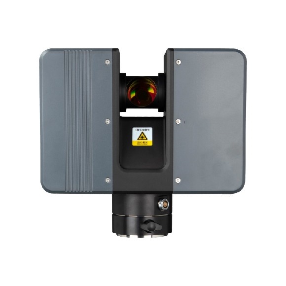
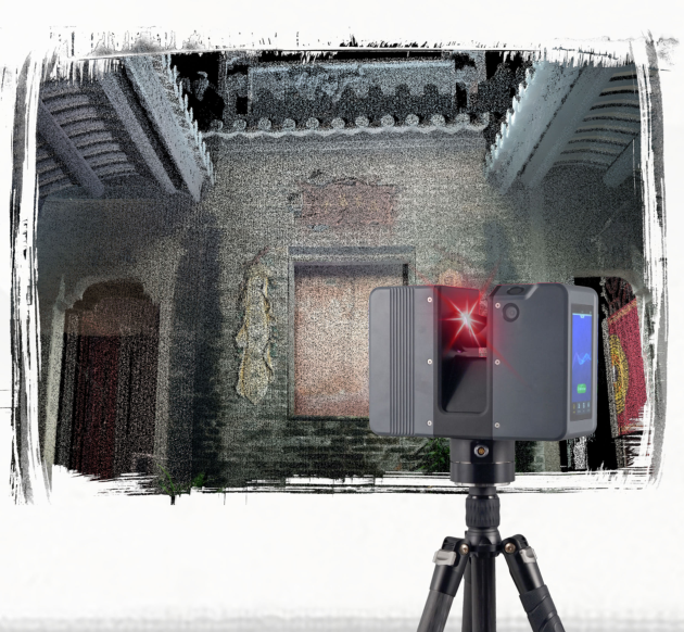
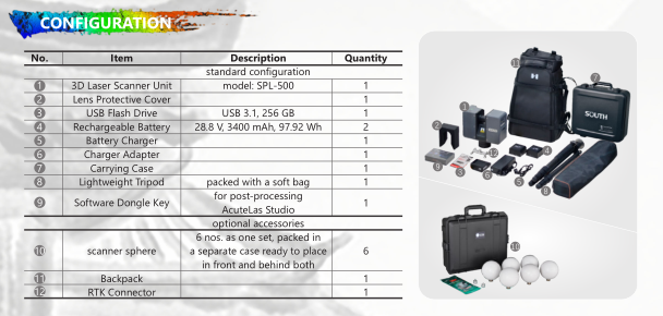
Unlocking Precision and Efficiency for the Future – SP1500 3D Laser Measurement System
With the continuous advancement of technology, 3D laser scanning technology is leading a revolution in the measurement field. Whether it’s construction, civil engineering, urban planning, or infrastructure maintenance, efficient and accurate measurement technology has become increasingly important. Among the many 3D laser measurement instruments, the SP1500 3D Laser Measurement System stands out as an industry leader, offering exceptional performance.

1. SP1500: A Perfect Combination of Precision and Intelligence
The SP1500 3D Laser Measurement System is designed to tackle complex measurement tasks, widely used in engineering construction, heritage conservation, mining surveying, and many other fields. It captures high-precision 3D data through laser scanning, quickly creating accurate point cloud models, and providing strong data support for subsequent design, analysis, and decision-making.
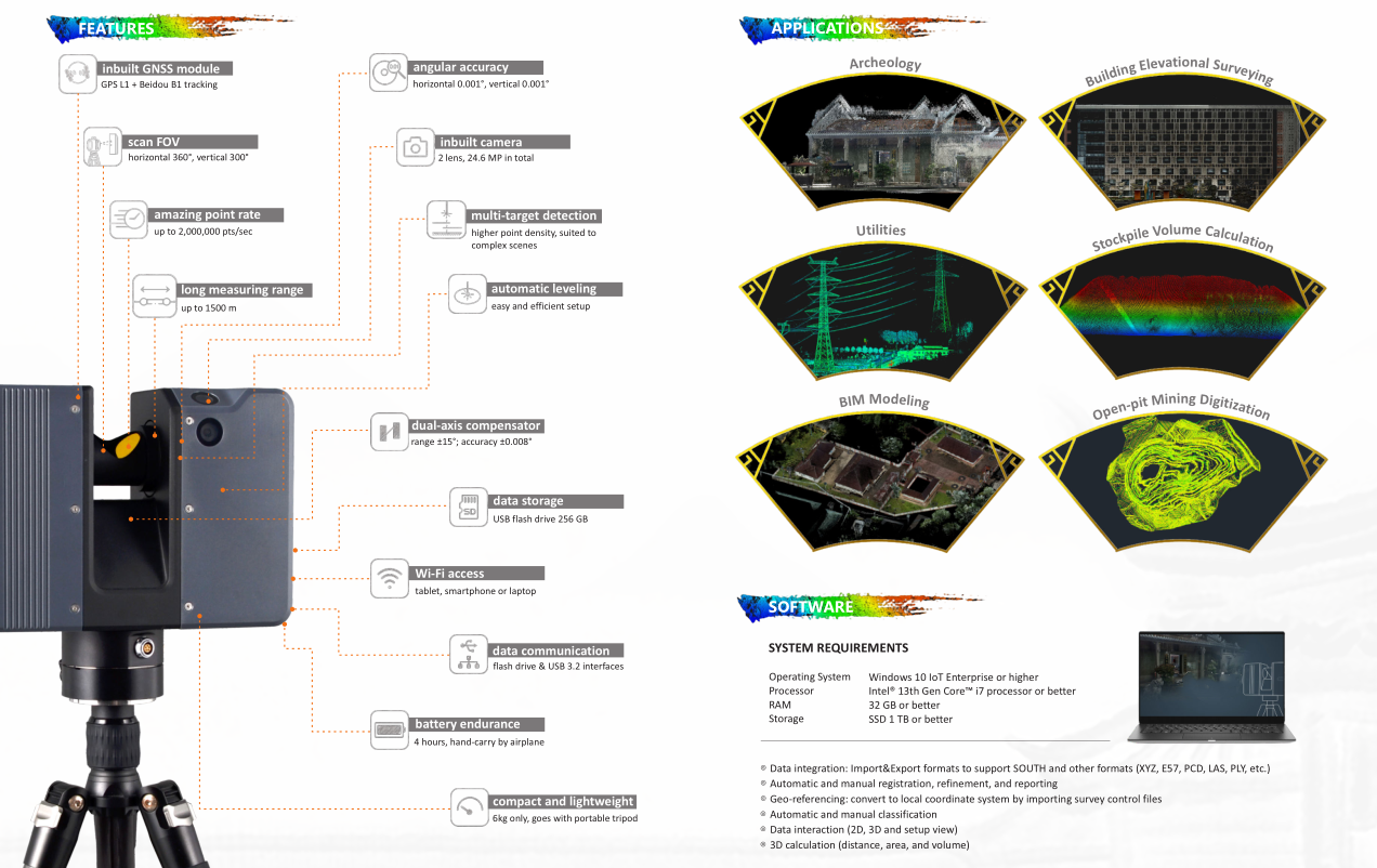
- Ultra-High Precision: The SP1500 achieves a measurement precision of up to ±2mm, ensuring the reliability of measurement results.
- Long-Range Scanning: With an exceptional scanning range of up to 500 meters, the SP1500 can perform precise measurements across a wide variety of complex environments.
- High-Speed Data Collection: The SP1500 supports scanning at millions of points per second, greatly improving data collection efficiency.
2. Innovative Technologies to Enhance Work Efficiency
The SP1500 is not just a high-precision measuring tool; it also incorporates several advanced technologies that optimize workflows, making measurement tasks more intelligent and efficient.
- Smart Automatic Calibration: The SP1500 is equipped with an automated calibration system that reduces human error, ensuring high measurement accuracy even in complex environments.
- Real-Time Data Processing: With a powerful data processing platform, the SP1500 is capable of real-time preliminary data analysis during scanning, significantly reducing work cycles.
- Multi-Point Cloud Fusion: The SP1500 supports the fusion of multiple point cloud data, allowing seamless integration of scanning results to form a complete 3D model, minimizing data gaps.

3. Adaptable to Complex Environments with Wide Applications
Whether it’s a vast construction site or a complex underground structure, the SP1500 is ready to handle it. Its robust and durable design allows the device to operate reliably in extreme environments. Whether dealing with high temperatures, low temperatures, or humid job sites, the SP1500 ensures stable performance.
- Construction Industry: From skyscrapers and bridges to municipal infrastructure, the SP1500 can quickly and accurately capture on-site data, providing precise data for engineering design.
- Heritage Conservation: The SP1500’s high-precision scanning technology helps heritage protection agencies quickly scan historical monuments and cultural relics, ensuring the accuracy of digital archiving.
- Underground Engineering: Specially suited for underground pipelines, tunnels, and other complex environments, the SP1500 can easily scan obstructed areas, capturing data from hard-to-reach regions.
4. Simple Operation and Multi-Platform Compatibility
The SP1500 features a simple, user-friendly interface and is equipped with powerful data processing software, allowing users to adjust settings according to their needs. Whether during on-site operation or post-processing of data, the SP1500 offers a smooth, seamless experience.
- Multi-Platform Compatibility: The SP1500 supports multiple operating systems, including Windows and Mac OS, and is compatible with a wide range of professional software platforms, making it easy to integrate with existing workflows.
- Cloud Data Storage: Users can directly upload scanned data to the cloud, enabling team members to access and analyze the data remotely, enhancing collaboration and efficiency.

5. Application Cases
- Large-Scale Construction Projects: In a major real estate development, the SP1500 was used to scan the building’s exterior and interior structure. The point cloud data collected provided precise data for the project’s design and construction, significantly increasing project efficiency.
- Cultural Heritage Protection: In the field of heritage conservation, the SP1500 provided digital protection data for several historical sites, ensuring that restoration work could rely on accurate, high-quality data.
- Infrastructure Inspection: The SP1500 played a crucial role in urban infrastructure inspection, quickly gathering 3D data of roads, bridges, and other facilities to ensure their safety and stability.

6. Conclusion
The SP1500 3D Laser Measurement System, with its exceptional precision, efficient operation, and intelligent user experience, has become the go-to tool for measurement experts across industries. No matter your field, the SP1500 can provide high-quality 3D data support for your projects, helping you gain a competitive edge in an increasingly fast-paced market.
Experience the SP1500 now and unlock a new era of precise measurement!
 Inteligente


